Airborne laser scanning reveals habitat features of wetland birds
23 March 2021
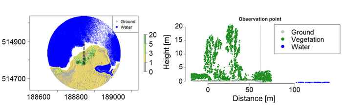
Even though it is well-known that numerous organisms depend on the physical structure of their habitats, the incorporation of such information into ecological niche analyses has been limited by the lack of adequate data over broad spatial extents. The use of airborne laser scanning (ALS), an aircraft measurement system that creates a 3D point cloud model of the landscape by emitting pulses of light to the ground, can fill in this research gap by providing direct information about the 3D physical structure of vegetation.
Countries such as the Netherlands now use this light detection and ranging (LiDAR) technology to derive national terrain maps every 4-5 years, but the 3D point cloud can also be used to quantify the structure of vegetation at high (meter) resolution.
Habitat structure
Researchers of the UvA Institute for Biodiversity and Ecosystem Dynamics and the Netherlands eScience Center processed data that was acquired during the third Dutch national ALS flight campaign between 2014 and 2019 to quantify niche filling, overlap and separation of closely related wetland bird species. ‘ALS can describe the variation in fine-scale habitat structure within wetlands and thus provides detailed information about the habitats of birds’, explains Zsófia Koma, PhD candidate at the Institute for Biodiversity and Ecosystem Dynamics (UvA) and first author of the study.
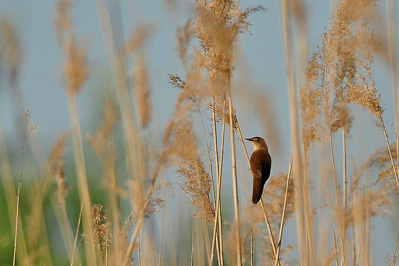
The research team combined the ALS data with breeding bird observations from a comprehensive bird monitoring scheme conducted by the Dutch Centre for Field Ornithology (SOVON). By combining these datasets the researchers were able to show that three closely related warbler species (great reed warbler, Eurasian reed warbler and Savi's warbler) separate their breeding habitat niches in relation to the vertical and horizontal structure of vegetation within wetlands. ‘While all three species show considerable niche overlap, they also differ in their occurrence densities within wetland habitat space, especially in relation to vertical vegetation structure like reed height, foliage height diversity and density of low vegetation and horizontal vegetation structure like extent, patchiness and height variability of reedbeds, and presence of shrubs, trees or water’, explains Koma.
Combining ecology with eScience
‘The processing of country-wide LiDAR data is challenging because ALS datasets at national scales encompass hundreds-of-billions of data points and tens-of-terabytes of data’, explains Daniel Kissling, Associate Professor of Quantitative Biodiversity Science at the UvA Institute for Biodiversity and Ecosystem Dynamics and senior author of the publication. ‘With the research project ‘eEcoLiDAR’ funded through the Netherlands eScience Center and the Dutch Research Council (NWO) we could develop a High Performance Computing (HPC) workflow that enables the efficient, scalable and distributed processing of such multi-terabyte LiDAR point clouds from national ALS surveys’, says Kissling .
The eScience Research Engineers of the team first had to develop new software that can process such massive LiDAR data in an efficient way, before it was possible to combine LiDAR data with ecological field observations and statistical models. ‘The combination of high resolution remote sensing data with ecological field observations is really exciting because it allows us new insights into the distribution of biodiversity across whole countries or even continents’, continues Kissling.
Biodiversity conservation
The increasing availability of open-access airborne laser scanning data provides new ways to study ecological niches and animal habitats in unprecedented detail over large spatial scales. In this way the ALS information goes beyond quantifying the climate niche and 2D habitat information from land cover maps and provides important information to identify habitat features and priorities for biodiversity conservation in wetlands and other habitats.
‘The next steps are to analyse the transferability of the developed method across different species as well as different land cover types to determine the most relevant set of LiDAR metrics for describing fine-scale habitat structure in the context of biodiversity conservation’, concludes Koma.
Publication details
Zsófia Koma, Meiert W. Grootes, Christiaan W. Meijer, Francesco Nattino, Arie C. Seijmonsbergen, Henk Sierdsema, Ruud Foppen and W. Daniel Kissling: 'Niche separation of wetland birds revealed from airborne laser scanning', in Ecography (2021). DOI: https://doi.org/10.1111/ecog.05371