Open-source software and tools developed for the eEcoLiDAR project
Light Detection and Ranging (LiDAR) technology can be used to characterize the vertical and horizontal complexity of vegetation and landscapes at high resolution across regional to continental scales.
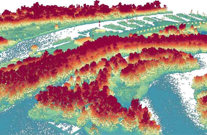
The newly LiDAR-derived 3D ecosystem structures can be applied in species distribution models for breeding birds in forests and marshlands, for insect pollinators in agricultural landscapes, and songbirds at stopover sites during migration. It is possible to reconstruct 3D ecosystem structure for animals at regional to continental scales.
With help of machine learning and visualizations, objects can be classified. Objects include trees, forests, vegetation strata, edges, bushes, hedges, reedbeds, etc. The newly developed eScience tools and data are available to other disciplines and applications in ecology and the Earth sciences.
Download eEcoLiDAR repositories
Contact information
Please contact us for more information