Field equipment
GIS-related hardware
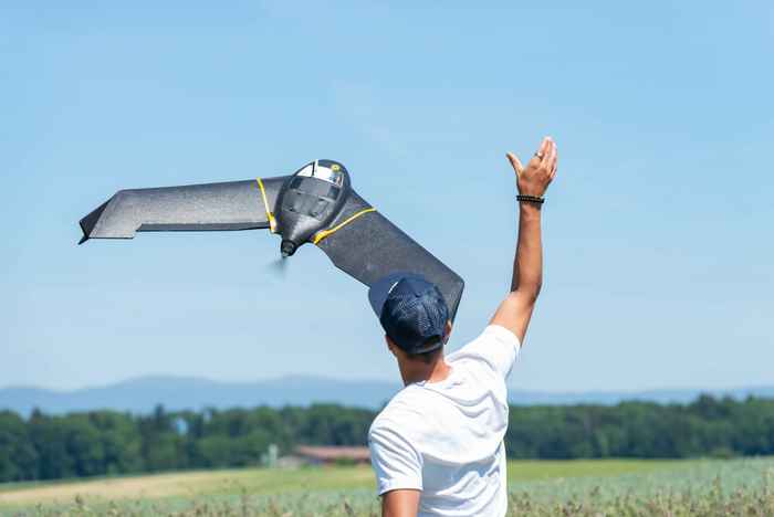
The GIS Studio can provide specialized hardware such as a fixed-wing drone with RGB and 3D-camera for surveying large areas, laser scanners for collecting data about vegetation and landscape features, GIS fieldwork tablets and a differential GPS (DGPS) station for satellite positioning and navigation.
If you are interested in using specialized hardware, you can look at the GIS Studio website for more information about equipment like these:
- Trimble Yuma7 rugged fieldwork tablets
- DJI Phantom 3 Advanced drone (quadcopter)
- senseFly eBeeX drone (fixed-wing)
- Topcon Hiper HR dGPS base station and rover
- Geoslam Zeb-Revo RT hand-held laser scanner
Contact for GIS-related hardware
Please contact us for more information
Multi-parameter sensors
Our multi- parameter sensors can simultaneously measure multiple physical as well as biogeochemical parameters in a water phase.
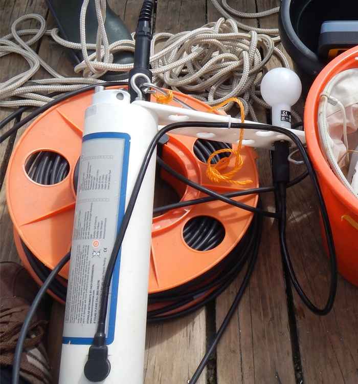
Hydrolab
The Hydrolab is a quality water multiprobe logger designed to be used in fresh, salt and polluted water. The instrument can measure various parameters including: temperature, depth, light intensity, pH, dissolved oxygen, specific conductivity and chlorophyll. The Hydrolab is typically used to obtain depth profiles of these physical and biogeochemical parameters.
-
Technical information
- Hydrolab DS5 or DS4a, Hach Company, Loverland, CO, USA
- Parameters: O2, pH, T, depth, Conductivity, CHl-a, Light intensity (PAR)
- Depth: 50 or 200m cables
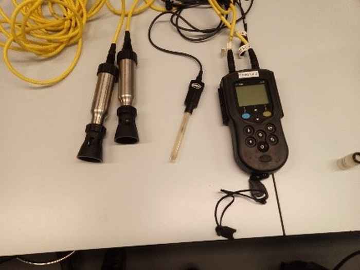
Hach HQd
The portable HQd has a rugged, waterproof and flexible design allowing connection of multiple probe parameters to the same meter. It is very suitable for measuring temperature, dissolved oxygen, pH and specific conductivity in the field.
-
Technical information
- HQD, Hach Lange
- Parameters: Temp, O2, Conductivity (5m cables) and pH (3m cable)
Spectro-radiometry
Spectro-radiometers are used to measure the spectral power distribution of a light source. From the spectral power distribution, the radiometric, photometric, and colorimetric quantities of light can be determined in order to measure and characterize the light sources.
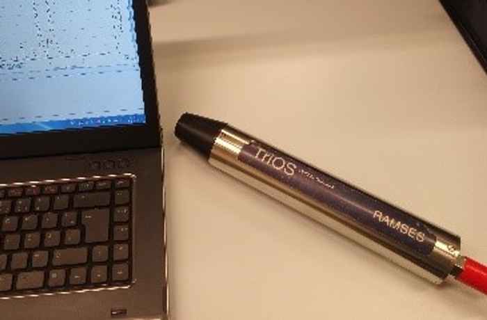
In our studies the RAMSES is used to measure spectral changes along a vertical water column.
RAMSES
The RAMSES radiometer is a spectral imaging radiometer to measure radiance, irradiance, or scalar irradiance in the UV, VIS and UV/VIS ranges.
The RAMSES can be used in the laboratory as in the field. Mounted in a frame it can be submerged to a depth of maximal 300m.
-
Technical information
RAMSES-ACC-VIS, TriOS GmbH, Germany
Spectral range: 320 to 950 nm, spectral accuracy 0.3 nm
Inclination and depth sensor
Maximum measuring depth: 300 m
Contact information
Please contact us for more information